This Garmin was meeting the exact specification that I had previously determined to be a prerequisite. What I had forgotten is that this feature is free for 3 months, though I would swear that I had noticed this occurring more recently. At least it does not require a compatible cell phone with data capability; it is built right into the Garmin 660 and appears to be a new one-time $50 life subscription (it was $60 per year). It does not seem to include weather, but then I'm no longer sure that I would want to be rerouted a few hundred miles to get around bad weather, especially since I can more or less plan for that ahead of time with a Weather Underground forecasting map, and once I'm on my way I don't like to get too far off the path. The main thing is to avoid heavy traffic, jams and road construction.
East, by northeast
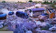
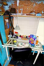
I left there on May 7 at 6:30 AM, heading east on Route 62. I had gotten up about 5:15 and carried my coffee up to my scenic view, soaking it all in and relaxing prior to the impending three day trip, which I never look forward to. As always I took a number of shots above, around and inside my digs so that I would have a record of how I left it, for whatever reason.
The night before I had pulled the van onto the cobbled driveway next to the trailer so that it could look like somebody might be there, and to make things difficult should somebody decide to make off with our solar panels or such. Fortunately that isn't likely since we are out of the way and because neighbors would see them, but it doesn't hurt to be a little cautious. I also left the bed unmade and some food on the table so again it would look like somebody might be there, and so that they could look through the deck-side windows and see that there is nothing inside worth breaking my door.
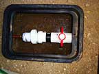
I unplugged the water heater, shut the water off at the main valve and opened the union adjacent to the valve to drain the system - that is the plumbing system; not the water tank. I finished loading those things that couldn't be loaded the night before, locked the place up and departed.
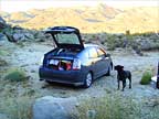
Molly was in the back seat in her cage with her head resting outside of the cage door. Four gallon jugs of water were on the floor behind and a cooler was stocked with various 'healthy' granola type snacks. Last year this had also included a large quantity of Wal-Mart's delicious malted milk balls which I inadvertently consumed to excess on that trip. This apparently affected my glucose level because subsequently my NP at the local VA clinic nearly had a cardiac arrest when she read my blood work, telling me that I was a hairline away from diabetes. Anyhow, during my upcoming physical this year she would prove to be much nicer, telling me that my readings came through with flying colors; the glucose was back to normal.
In the very back of the car was my suitcase, a collection of glues, silicones and wood putty that would just dry up if I left them behind - and a chair. Yes! A chair. Eileen had purchased an old insignificant wooden kitchen chair at a local thrift shop and insisted that it be delivered back to her shop on the Cape where she could sell it and make a few bucks. This made no sense to me; I read her the riot act a number of times and told her I was definitely not going to waste my time and effort and space messing with a useless chair. As I write this I believe it still sits in her shop unsold, only serving to add a certain look to the ambiance of her shop. Sometimes I think she is more interested in how her shop 'looks' then in whether or not things actually sell. I have made it clear that this must never happen again!
Also back there was a grocery bag full of doll house furniture that I had found at a local estate sale, primarily old western player piano music boxes. These would also go into Eileen's shop on consignment. She has since made a handsome income off of these and I have more then tripled my money, with items still remaining to sell.
I stopped in 29 Palms at the Denny's and enjoyed a large Lumberjack breakfast, then northeast on long straight fast back roads around the Marine base to I-40. At that point in previous years I had then gotten on the interstate heading east, perhaps turning northeast at Oklahoma City, or if it looked like tornadoes might be up that way I would continue east to Tennessee and then head north. The latter was the route we had taken in reverse in December to minimize the chance of ice and snow.
During the 3 or 4 days prior to departure on most trips I keep a close eye on the
Weather Underground map which does a nice job of graphically depicting the forecast. It helps me get a feel for what to expect and what routes to avoid.
I had never taken the northern route and was curious about it. The weather appeared to be good that way so I went north on I-15, eventually driving by many cities that I had flown into and taxied through, but never driven to. That is in reference to more than a decade of handling the dozen or so computers that would be set up, maintained, dismantled and shipped for the Emotion Mining Company, a marketing firm that was introducing a novel method for finding out what people really feel about a product or concept, as opposed to what they think the moderator wants to hear. I also wrote the interactive data-gathering graphic software that Emotion Mining used during that period.
BTW, when I make such absolute statements such as "never", I am referring to this phase of my life where I have pretty good hi-tech records and organic memory just doesn't matter. In a previous lifetime during the 60's and 70's I drove between the coasts a number of times but I do not remember what routes I took, this being further exasperated by the fact that the routes have changed: I-40 used to be Route 66, I-195 to the Cape used to be Route 6, etc.. However I do have a stockpile of old calendars, check registers and letters stored away in boxes and one day I may just go through those potent memories and piece a chronological sequence of events together, but for now all I have are disconnected tidbits of memory that have little relevance to the present.
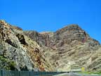
This trip took me northeast by Las Vegas, into Utah, east/northeast on I-70 to Denver, then I-76 to I-80, then Omaha, Chicago, Cleveland, Erie, Buffalo, Albany, and southeast through Massachusetts to our home on the Cape. The trip was way more scenic and interesting then I had expected and mostly uneventful until somewhere east of the Mississippi River where I encountered a horrendous thunderstorm after dark on roads that were under construction and difficult to navigate. I almost felt that my life was in the balance during that stretch.
I had spent the previous night in a rest stop east of Denver which is when I determined that the Prius was not made for sleeping, especially when there is a dog cage in back that will not allow the seat back to drop down. On this 2nd night I was definitely ready for a real bed. When the storm hit I got off at the first exit, at Davenport Illinois, and pulled into the first motel, which was full so I made it to the next motel that had one $120 room, so I filled my tank to make the stop worth something and then found my way back through the downpour to the interstate and drove onward. That was about 10 PM.
It was probably another 60 miles, 1 1/2 hours, before I found a Days Inn, which usually have pretty good rates. That was in Princeton, Illinois and the rate was about $60, inclusive. I paid an extra $6 to bring Molly in to get her out of the storm. As we approached the room Molly became suddenly excited, pulling on the short leash as I slipped the card in the slot, jerking the leash out of my hand as the door opened, and racing to the large bed to stop and stare up into it, apparently in some confusion. Then it dawned on me. All of her past experiences of approaching a motel room in a similar manner after unpacking the car, had found Eileen in the room and in the bed or shower. Molly did in fact check out the bathroom next to find that there was no sign of Eileen, which she then accepted as she found a spot on the floor to lay down and go to sleep for the night. That proved to be a very pleasant and restful night for both of us.
Passing Cleveland on the 3rd day, I decided to take the longer route northeast on I-90 up though New York instead of going straight east on I-80 through Pennsylvania. The latter would have thrown me right into the New Jersey-New York City melee which is always slightly or significantly disconcerting, depending on traffic. Also it was the same old same old; been there, done that; where it would be nice to avoid all of that and try something new. I had already been hit by unexpected tolls in Indiana and Ohio, so maybe it would be nice to avoid the Pennsylvania tolls. At least Indiana was good enough to take my card but Ohio had required cash. This cash thing to me is totally unnecessary if not imposing. Though fortunately I had carried enough cash for emergencies, I prefer not to use it because it is one more receipt I have to remember to ask for and keep track of, where a card expense is a simple download into Quicken after the trip is over. As it turned out, New York State and Massachusetts also have tolls and require cash, making this northern route the most expensive and inconvenient.
Near Pembroke NY, about 20 miles east of Buffalo, I experienced one of the most powerful winds I have ever encountered. Coming down a long steep corridor I had pulled off the interstate into the travel plaza. There was one other car in the lot and some trucks over in their lot. I tied Molly outside of the car with food and water and went inside. I went to the men's room, the reason I needed to stop now, and bought a coffee. When I went to the exit the travel plaza I found it very difficult to open to push the doors open. When I did manage to exit I found myself suddenly fighting a very powerful wind, having to bend forward and low to make any headway into it. Trash receptacles were tumbling across the parking lot and trees were bending over. I could see that Molly was okay on the lee side of the car but I still felt a need to get her and I into the car fast.
I had opted to leave the coffee lid behind because I planned to pour it into another cup that I prefer to drink from. So the coffee was erupting in waves as it blew out of the cup across my arm. I made it to the car, opened the passenger door and set the coffee into a cup holder. Then I walked Molly to the nearby grass, a necessity regardless of the weather, as we both leaned into the wind and thank god she quickly did her thing. I put her back in through the rear door and then I dove in through the passenger door over the consol and into my seat. Wow!
We get winds in JT that blow the plastic chairs across the deck but nothing like this. The last time I was in a wind this powerful was during
Hurricane Bob on Mashnee Island on the Cape in 1991. Through my windows I had watched it topple the trees around my place, but not on it.
Then I watched a tall Linden uproot and lean onto my neighbor's roof. There was no rain in this hurricane so I could see them, an older couple, looking out through a window terrified as the tree rocked and rolled grinding away at their roof. I grabbed my chainsaw. Hiding behind other trees during the strongest blows, I would intermittently run out to the downed tree and cut up into the trunk from below, and then another cut just above the roots that still gripped the earth, until eventually the main trunk sagged to the ground and the top of the tree hinged towards me where I was able to throw a rope tied to a hammer up through the branches, tie it down and then winch it away from the house until it fell onto their lawn.
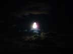
This Pembroke blow was almost that powerful. I realized that I did not want to be a sitting duck for god knows what in that parking lot so I got back out on the interstate and rode with the wind downhill until just as suddenly it was gone. I explored the local radio stations for awhile but heard no mention of it. As I continued into the night the full moon in the black sky reflected eerily through heavy fast moving clouds high overhead. I wanted to pull over just to get some shots of this astounding sky, but pulling over at night would not be advisable, and I wanted to get home, so I settled on getting a few through the window as I focused my attention on the road. Of course all of those shots were blurred.
I pulled into our driveway at about 2:00 AM, tired and glad to be there. Though Molly is not normally allowed to roam the house I quietly unlocked the door and let us in. I waved her to the stairs which she readily climbed, running straight to the bed and up onto Eileen who sort of screamed and laughed herself awake, delighted to have us back.
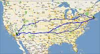
Of the 3 primary routes across country, the southern route, the mid-west route, this northern route, this is probably the most expensive. I paid $32.40 in tolls. Looking up the tolls for the mid route (GWB east, PA Tpk, OK Tpk) add up to $31. Tolls on the southern route are $8 (George Washington Bridge) heading east; $0 heading west. Gas tends to be less expensive along the southern route perhaps because the stations are closer to the source, until you hit Southern CA where the gas tax skyrockets. I have noticed that motels along that route tend to be cheaper also. Food is probably about the same.
This trip was 3009 miles house to house. Trips we took along the mid route were a little less. Those on the southern route were 60 miles or so more. My calculations were based on beginning and ending mileage so they would include the inevitable diversions. Running each route through Google Maps shows the northern route being 2991 miles town to town, the mid route 2910 miles, and the southern route 3025 miles.
There is a 4th route that we have taken when winter weather got bad on I-40, and that is I-10 from Little Rock southwest to the Mexican border then up through Phoenix and Palm Springs. This adds 200 miles to the trip so it is not normally a consideration.
A GPS learning experience
A long time ago I began reading about the wonders of the GPS device. My favorite tech guru, Fred Langa, had begun using and writing about them in his newsletter,
The Langalist (which has since merged with
Windows Secrets, another excellent newsletter). I also followed the more detailed
GPS reviews over the years as the technology progressed. Specifically I was waiting for the time when an affordable GPS could detect bad weather and/or traffic ahead, alert me, and show me an alternate route. Until it could do that, I did not think it would be all that useful. How naive I was.
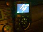
On December 26 2006 we rented a Hertz for the trip west and it included a GPS device. Wow! It was crude compared to the ones that I had been reading about but it was my first and it was exciting. I quickly discovered how nice it was to just have this new way of knowing at any given moment where we were and where we were going. It would even tell us where the gas stations, restaurants and motels were up ahead. When we discovered in Mystic that we had forgotten the dog food, it guided us to the nearest supermarket. Cool!
On January 26 2007, one month later, we were again visiting with Eileen's son in Tempe, and again getting totally lost in the Phoenix-Tempe-Scottsdale-Mesa-Gilbert-Glendale-Phoenix area where everything looks alike and everything runs together into one big congested mishmash of endless roads - except for the roads that suddenly end - and the roads that aren't even on the paper maps, like Jody's place. We were driving our big rumbling gas guzzling Dodge Ram Van where every lost mile is sorely missed. In desperation I got directions to the nearest Best Buy and bought my first GPS, a TomTom One ["Second Edition", 4N00.004.2] because it had the most features for the price. That was the last time I had to get directions to anywhere. That device knew the 'metro' area well and had no problem taking us straight to Jody's house.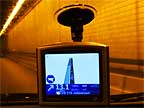
From mile one it was a match made in heaven. I am sure that over time it saved us enough in un-wasted gas to pay for itself. The TomTom even offered 'real time information on traffic congestions and weather conditions' but as a paid subscription which also required a compatible cell phone and compatible cellular data plan which you pay extra for. In other words, the traffic-weather option was not an option for us.
Note: I am describing the learning process as I experienced it. Below, I will get into the more current options becoming available now (August, 2009). Keep in mind that all that will have changed by the time you read this. For instance, I think you will find the cost of traffic services becoming much less expensive even as the quality dramatically improves.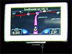
My TomTom also developed a memory-wipe problem that I
described in the 2007 newsletter, which basically meant keeping a spare fully-loaded memory card on hand at all times. A search on this anomaly reveals that others have had similar problems which did not seem to get resolved. Hopefully the newer models don't have that problem.
For this reason, on July 15 2008, after a year and a half of this TomTom, I bought a Garmin Nuvi 660 in hopes that it would be more reliable. Having now used it for over a year I have to say that even though it has not self-destructed I do not like it as much as I did the TomTom. The Garmin voices are computerease neutral, i.e.: boring, where the TomTom voice I selected was very real, like another passenger in the car. Where the TomTom would increase in volume at higher speeds so I always knew what she was saying, the Garmin is often difficult to hear in traffic. Now even that has recently developed a problem where the voice has become tinny and even more difficult to understand, and the 1 year warranty has run out.
One disconcerting but ultimately nice discovery with this Garmin: occasionally there were times when it seemed to be taking me in a less logical direction. I would reselect the destination and it would still try to take me the 'wrong' way. Having to keep my attention on the road, I could not study the screen to see what was going on. One time while parked outside of a restaurant I did happen to notice this round-about display before I took off, so I studied it. That is when I discovered that a stretch of road in the 'right' direction was showing some kind of traffic congestion ahead. The GPS was just trying to get me around it. Cool! Though I would prefer to be told in big bold letters when it is doing this, it is definitely something I could come to accept.
TomTom now sells a separate
FM Traffic Receiver [RDS-TMC] that connects between the car adapter and the GPS. The receiver provides
live traffic information as it becomes available through departments of transportation, traffic helicopters, police scanners and other methods. "One year of free traffic data is included" with the receiver. (When ordering a receiver, make sure you get the right one for your model TomTom.) Where that involves a lot of loose wire and suction cups, they have just begun to offer a new built in unit: "Currently, TomTom LIVE Services are only available on the TomTom GO 740 LIVE." That one requires a $10 monthly subscription but it can be cancelled when unneeded. TomTom still offers the original 'Plus' cell phone method but that just seems like an expensive nuisance.
There is a great new feature included in the newer TomTom units that should help remedy one big problem with the GPS databases (maps, businesses, etc.) being out of date. TomTom calls it 'Map Share'. Our TomTom in 2007 was totally unaware that
Perris, CA had recreated its streets. We ran into a few dead-ends before we finally found our way back to the highway that leads to Elsinore. In 2008, heading for
Rosita's Restaurant in Tempe, AZ our Garmin diverted us left and around the block even though there was a more direct route straight ahead. This had also occured the year before when our TomTom was in charge. For some reason the maping databases were unaware that Mill Road did continue to exist between Broadway and University.
The new TomTom Map Share feature allows people like us to send corrections back up to the database and optionally download corrections made by others. Garmin provides a
web page for reporting map errors, but it is not as interactive as the TomTom setup. I think the basic difference is that Garmin requires that all suggested corrections be reviewed and verified by experts, whereas TomTom allows us to select the desired level of verification and download corrections accordingly.
Regarding new full map updates, order the DVD. The equivilent download is so massive that it can put you out of business until the download is done and you will need to keep an eye on it in case the connection breaks. Get the DVD installation going before you go to bed for the night since it can take a few hours to install. To begin with, you will need to stop everything else that is running on your computer, so you will be out of business anyhow.
The GPS technology is advancing rapidly, as are computers, cameras, TVs and cell phones. It is getting much closer to something I began predicting around the turn of the century in the Delphi discussion forums that I was part of at the time. I believe that all of these devices will become one, something the size of a credit card or hearing aid, or perhaps as a 'smart' material rather than a device. It will probably present its 3-D displays holographically in the air before you, and it will take input by some combination of voice and thought, though that holographic image could also include touch-screen technology with touch-feedback - even including a keyboard, mouse or Wii-like remote for those who want a 'hands-on' feel. All of these features are already available in larger devices one way or another, individually or in combination - or are being developed. The smartphones (micro-computers in and of themselves) are getting there. As they progress and as affordable holography becomes a reality, we may see it happen, perhaps soon.
The End
That's about it until next year. If you enjoyed reading this, or did not, leave a comment on the main
2008 Joshua Tree page.
Bye.
|
Copyright © 2009, Van Blakeman |